Open City Data
Angela and I recently attended a meeting in San Diego held by local advocacy group OpenSanDiego. We heard from the city they are taking timid first steps to consolidate and open up their data, along with modernizing their website. The city wanted to know what we, the tech industry, would do with data once it was opened up and why we wanted it in the first place. San Diego is not entering uncharted territory, so let’s explore the state of open data around the country.
Many Cities Are Already Open
There are many cities around the United States and the world which are already opening up their data sets to the public. Data.gov has a list of U.S. cities with open data policies. Large cities such as New York City, Los Angeles, Chicago, Boston, Seattle and San Fransisco, all the way to smaller cities such as Champaign, IL, Wellington, FL, and Burlington, VT have jumped on board. Examples of the types of things developers have created with these data sets can be viewed at Data.gov
A couple of my favorites include:
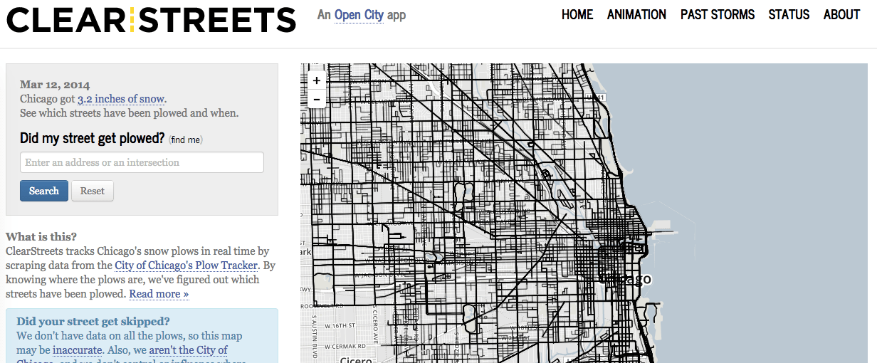
Clear Streets, http://clearstreets.org/, Chicago. Uses GPS data dumps from the city’s snow plows to create a beautiful visualization of what it takes to clear the streets.

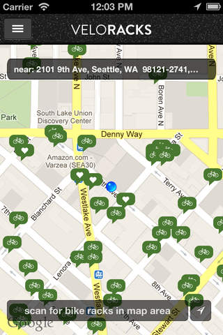
Velo Racks, http://www.veloracks.com/, Seattle. Allows users to view bike racks close to them.

It is important to point out all of these apps were enabled just by allowing the public to access pre-existing datasets. Many cities, including San Diego, already have laws requiring public officials to provide data to its citizens, providing an open data portal simply allows self service of these data requests. This lowers the bar for using city data while allowing city employees to do the job they were hired for, rather than running around trying to find, copy, and then provide data to a one-off request. This runs counter to some voices in government who are worried that creating an open data portal could tie down their employees’ time with answering an onslaught of questions.
San Diego has stated that they too want to provide an open data portal to its citizens[http://nationswell.com/san-diego-joins-open-data-movement/], and work is being done right now to achieve this goal. How soon will San Diego join the list of open data cities at Data.gov[http://www.data.gov/open-gov/]? Let’s open up the data that powers this wonderful city, and see what comes of it.
Data Wishlist
Here are a couple of San Diego data sets that I personally would like to have access to:
1. A detailed map of San Diego City streets and sidewalks.
This data could be uploaded to Open Street Maps, the Wikipedia of maps. This type of data could assist major projects such as the million dollar multi-year project to assess the quality of our city’s sidewalks.
2. A detailed map of San Diego’s neighborhood limits.
Where does University Heights end and Hillcrest begin? I have scoured the city’s website for maps of neighborhood boundaries, but have not come across anything concrete or consistent.
3. Access to permit applications to operate breweries within the city limits.
I am building a website to keep track of all the amazing breweries and beers in the city; I could use this data to find breweries that don’t even exist yet.
Opening up San Diego’s data might lead to some silly apps, or some useful websites. As a developer I want the city to take this first step forward to provide the data – not for the quirky apps, but because open data means more government transparency, it means a lower barrier-to-entry for future companies that are fueled by government data, and it may mean lower costs for the city. It means entering the 21st century – and we’re already late to the party.
Back To All Posts?